Indicative flood plain and flood risk assessment
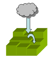
To calculate the extent of flooding likely to
take place under each climate change scenario, the game estimates the effects
of each of the climate change parameters on river and coastal flows. It does
this using a precipitation model to derive flows into a drainage network. Extreme
events such as rainstorms and storm surges are introduced throughout each decade.
The precipitation model is based on delivering varying amounts of rainfall
into the upland and lowland areas of the landscape according to the different
climate change scenarios. The runoff is determined by the permeability of the
underlying geology and is influenced by a north-south gradient. Together these
represent the water flowing into the drainage network. Rainstorm events of
different sizes and frequency add to the amount of rain delivered into the
catchment within each decade. Similarly, tidal height, sea level rise, coastal
subsidence and storm surges add to the volume of water entering the catchment.
All four contribute to the calculation in the flood model of the indicative
flood plain, and assessment of risk of coastal flooding and risk of river flood.
- : the average annual rainfall
over each decade and modified by altitude and the north-south gradient
is allowed to drop onto each grid
square.
- : the amount of water that flows down each section
of the river is affected by the permeability of the underlying geology.
The
scale is
normalised from peat (0.1) to clay (0.3) to Carboniferous limestone (0.8)
-
: this is created by accumulating
flow from each grid square in the elevation model. Flow always follows
the steepest
path to
the sea. If
the water reaches an area where there is no immediate downward
flow, then it accumulates until the height of water in the depression is
enough
to flow downwards
again.
- :
this is calculated using the volume of water accumulated in the drainage
network. At each point
in the
network, the volume of water
present is distributed sideways, so that when there is more water
it extends further outwards. The colour scale shows the event
horizon or frequency (e.g.
a 1 in 100 year event) of the sideways spread; red is 1:5 and
blue is 1:100.
- : the size and frequency depend on
the climate change scenario. For Medium-High and High the frequency increases
threefold over the decade
and the event scales with the increase in average annual precipitation.
For Low and Low-Medium the frequency increases twofold. The
events are sampled
randomly over the decade for 1:5, 1:10, 1:20, 1:30, 1:50, 1:75,
1:100.
- : the size and frequency depend on the
climate change scenario. For Medium-High and High the frequency increases
threefold
over the decade
and the event scales in the same way as rainstorm events.
For
Low and Low-Medium the frequency increases twofold. [No other
evidence
on storm surge scaling
is currently available]. The events are sampled randomly
over the decade for 1:5, 1:10, 1:20, 1:30, 1:50, 1:75, 1:100, 1:150,
1:200.
- : sea-level rise changes according to
the climate change scenario and adds to tidal height. The maximum
value
of 1m occurs under the High scenario.
- : current calculations of the natural rates
of tectonically induced sea-level rise
resulting
from post-glacial
subsidence
are estimated at 1.8mm/year.